A Vision for the Baylands

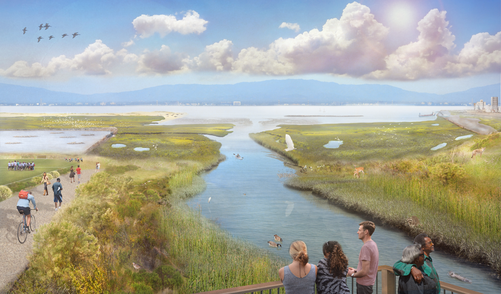
Artist’s rendering of an envisioned future baylands depicting implementation of the regional strategies to promote resilience in the baylands landscape, its habitats, and wildlife. Here a local creek has been reconnected to the baylands, delivering sediment and freshwater directly into the marsh, which helps the marsh rise in elevation as sea level rises. This restored connection also creates a gradient of fresh to brackish to salt marsh, providing different habitats for wildlife. The salt marsh has a robust, complex channel system, pannes, and an undeveloped transition zone to the upland. Protected and enhanced transition zone supports native plants and animals, and provides a place for the marsh to migrate landward as sea level rises. The continuous transition zone around the baylands and up the creek is a corridor for wildlife movement and a place for marsh animals to find refuge from high water and predators. A managed pond with constructed islands adds complexity to the landscape mosaic of habitats, providing essential support for water birds. This complete tidal wetland system also includes a mudflat, barrier beach and oyster reef on the bay side, all of which support greater biodiversity and physically protect the adjacent marsh and shoreline. The marsh restoration in progress at the far right uses dredged sediment to allow the restored marsh to achieve a higher elevation prior to sea-level rise acceleration around midcentury, which will better sequester carbon and create a continuous corridor of marsh for wildlife movement along the shore. Integrated management and monitoring allows for thriving natural systems in close proximity to urban citizens. (Illustration copyright Nate Kauffman)
